
About
From Sweden’s High Coast to the Global Stage: Mapping Nature, Culture, and Innovation
Transforming raw data into breathtaking visual narratives that drive sustainable change.
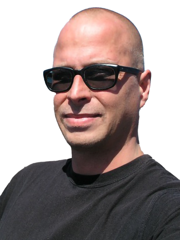
Hi, I’m Mats Wedin—your dedicated map maker, GIS specialist, and creative storyteller. Born in Sweden, I spent my formative years on my grandparents’ farm along the breathtaking High Coast, where my passion for nature, geography, and environmental conservation was ignited. As a teenager with Fältbiologerna (Youth and Environment Sweden), I embraced biodiversity activism and sustainability—values that continue to guide my work.
I honed my illustration and art direction skills at Schmidt & Magnusson’s advertising agency in Stockholm, creating high-end B2B campaigns for global tech and industrial clients. In 1999, I moved to the Galapagos Islands to apply my expertise at the Charles Darwin Research Station, and over the past two decades, I’ve merged GIS analysis, cartographic visualization, and creative storytelling to transform complex data into compelling maps.
I’ve had the privilege to collaborate with renowned organizations such as USAID, The World Bank, SNV, and DAI Global—completing 400+ projects for over 150 clients worldwide in areas like climate resilience, biodiversity conservation, marine mapping, and strategic urban planning.
Proficient in GIS, design, and 3D software, and fluent in Swedish, English, and Spanish, I’ve worked across continents and cultures. Now based in Cuenca, Ecuador, I continue my cartographic work while enjoying hiking, photography, and the vibrant Andean landscape. Every map I create tells a story—and I’m here to help you tell yours.
Recent Experiences
2023-2025
USAID
GIS and Data Visualization Specialist
Supporting ACE (Advancing Capacity for the Environment), USAID’s global program focused on tackling climate change, conserving biodiversity, and advancing sustainable natural resource management. Through ACE, I’ve had the opportunity to develop specialized maps and data visualizations that deliver critical insights, informing high-level decisions and communications— including by the Administrator of USAID.
2025
SNV
GIS Consultant
As a GIS Consultant for SNV, I was responsible for developing spatial implementation maps to enhance project planning, monitoring, and communication. SNV Rwanda implements three distinct projects across Rwanda’s 30 districts, and my role focused on creating clear, data-driven maps that support effective decision-making and resource allocation.
2021-2024
DAI
GIS Specialist & Cartographer
Provided specialized GIS, cartography, and data visualization services across multiple USAID-funded and international development projects. Delivered high-impact maps, spatial analysis, and visual materials for environmental and climate resilience initiatives in regions including Uganda, Pakistan, Nepal, Madagascar, Indonesia, the Americas, and West Africa. Collaborated on projects such as:
– Uganda Feed the Future/Water and Food Systems for Resilient Communities Activity (WFRCA): Supported GIS needs to enhance water and food security efforts.
– Pakistan Climate Resilient Water Governance (CRWG): Created mapping and visualization tools for climate adaptation strategies.
– Nepal Agricultural Transformation and other proposals: Provided GIS support for agricultural and environmental planning.
2018-2025
The Stable Group
Cartographer/GIS Specialist
I have been providing ongoing GIS and mapping support for roads and rail infrastructure projects. Developing maps and spatial data visualizations to advance project planning, strategic prioritization, and funding applications, supporting critical infrastructure initiatives.
2018-2025
Expedition Map
Cartographer
Ongoing cartography and GIS services for a unique collection of travel and custom art maps. Projects include crafting highly detailed folded expedition maps of locations such as the Arctic, French Polynesia, and the Pacific Northwest Coast, enhancing travelers’ experiences and preserving their journeys.
2020
The Nature Conservancy
Cartographer and Illustrator
I worked as a Cartographer and Illustrator for the publication “El Carmen de Jadán y su relación con el agua: pasado, presente y futuro,” organized by The Nature Conservancy (TNC) and the Fondo del Agua para la Conservación de la Cuenca del Río Paute (FONAPA). My role involved creating thematic maps, illustrations, and visual resources to depict the community’s history and efforts in conserving their natural resources, particularly water governance, forest conservation, and watershed management. I collaborated with a multidisciplinary team, integrating community perspectives with technical and scientific data, and utilized various project management tools to ensure effective coordination and delivery of project objectives.
More experiences
Get my CV or have a look on LinkedIn
Discover more about my journey, projects, and professional achievements by contacting me for a copy of my CV or checking out my LinkedIn profile. Whether you’re looking to collaborate or simply want to learn more, these resources offer an in-depth look at my expertise and the impactful work I’ve done around the globe.