
Cartography and GIS Services
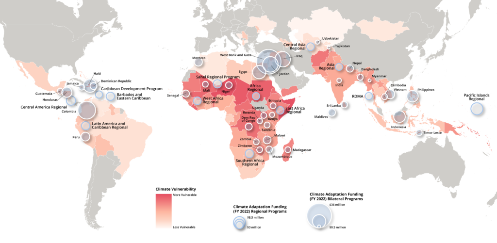
Empowering Global Development & Humanitarian Initiatives
From mapping critical data for USAID and international NGOs to designing visuals that support policy-making, I deliver precise GIS and cartographic solutions tailored for public service and development.
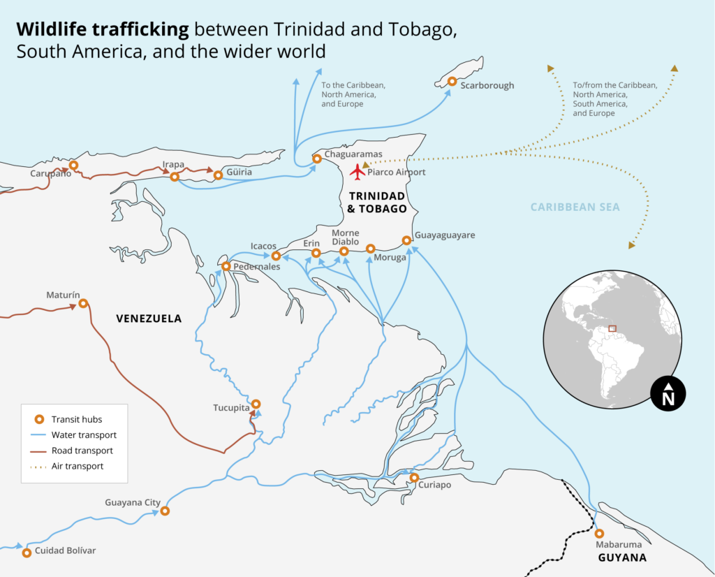
Advancing Conservation Efforts Through Innovative Cartography
Driven by a passion to protect our planet, I specialize in creating maps that reveal critical environmental data. My work in conservation, biodiversity, ecology, and climate change transforms raw data into clear, impactful visuals—helping decision-makers, conservationists, and researchers understand ecological challenges and opportunities. Whether it’s identifying climate vulnerability zones, tracking biodiversity hotspots, or visualizing environmental impact, my cartographic solutions provide the clarity needed for effective conservation planning
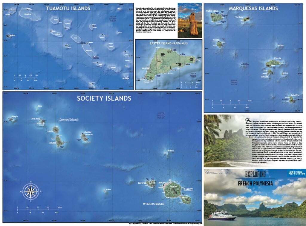
Bringing Destinations to Life
In the tourism and hospitality sector, a well-crafted map does more than show locations—it creates an immersive experience. I design detailed maps that guide visitors through attractions, routes, and hidden gems, ensuring that lodges, camps, and tour companies can present their offerings in a visually captivating way. My maps not only serve as navigational tools but also as storytelling devices that capture the spirit of a destination, encouraging exploration and enriching the visitor experience.
Transforming Data into Visual Narratives
Maps are powerful tools for storytelling and scientific communication. I work with researchers, writers, and publishers to convert complex datasets and narratives into clear, journal-quality visuals. Whether it’s illustrating academic research, enhancing a publication, or crafting a visual companion for a written story, my cartographic work brings data to life. The result is a blend of scientific rigor and creative design that makes complex information accessible and engaging
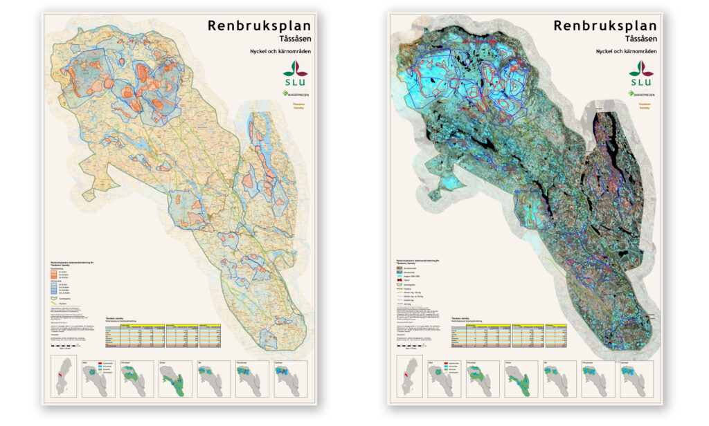
Mapping the Future of Urban & Regional Development
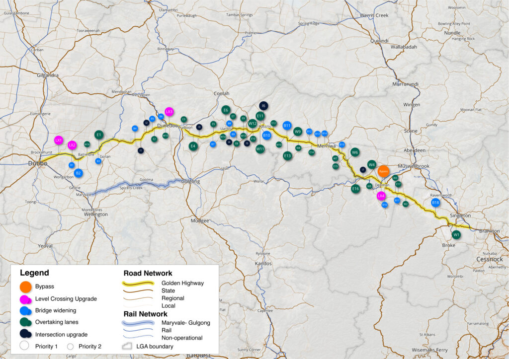
Accurate and detailed mapping is essential for urban planning, real estate development, and infrastructure projects. I provide comprehensive cartographic services that support everything from site planning and zoning analysis to marketing and development proposals. My maps integrate technical data with visually appealing design, ensuring that stakeholders—from developers and planners to investors and municipal leaders—can make well-informed decisions. Every project is tailored to meet the specific needs of the client, ensuring clarity, precision, and strategic value.
My 6-Step Workflow: From Data to Dynamic Maps
Discover our proven process for transforming raw data into compelling, tailor-made maps. Each step of our workflow—from gathering requirements to delivering final, dynamic products—is designed to ensure precision, clarity, and creativity. Whether your project demands printed maps, static visuals, interactive digital products, or a combination, our methodical approach guarantees results that meet your unique needs and exceed your expectations.
Define Requirements
Meet with the client to clarify objectives, determine project scope, and decide on the final product mix—whether printed, static, interactive, or a combination.
Collect & Verify Data
Source or develop the necessary spatial data and validate its accuracy to ensure it meets the project’s requirements.
Process & Analyze Data
Use GIS tools to process the data, perform spatial analysis, and extract key insights that will form the foundation of the map.
Design & Develop Visuals
Create compelling visualizations by translating analyzed data into map designs. This step involves crafting static visuals and integrating digital or interactive elements as needed.
Review & Iterate
Present draft versions to the client, gather detailed feedback, and refine the maps until they align with both the functional and aesthetic goals.
Deliver & Support
Provide the final product in the agreed-upon formats and offer ongoing support to ensure the map meets client needs during implementation and beyond.